Sunday 24 February 2013

24/02/13 - Bigge up the Tarde

Distance - 4.7 Miles
Geocaches - 6
Walk from - Cicerone Walks in Worcestershire
Similar Walk

This weekend does not have enough free time in it, being totally dominated by football.  Yesterday, was 65th Birthday celebrations at the Albion.  They had the decency to win for us.  Today, Alex is playing in a cup game in Worcester.  They lost 8-0.  And it was very cold.

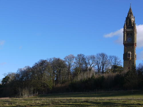
Needed to get for some sort of walk and I realise that I have a walking book that is virginial.  Not one walk has been completed from a Worcestershire Walking Book.  I decide to do one along Tardebigge Locks, starting at the impressive church on the hill.  Not new territory for me, but it will get me out the house.

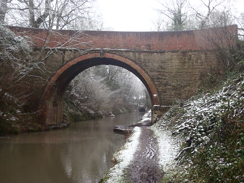
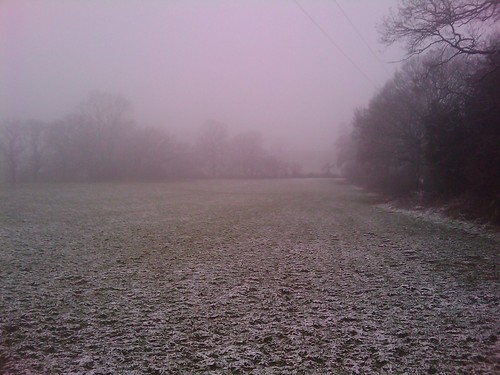
Park up at the Picnic area by the Church.  There are two caches - I will save one for the return and get the one just down in the fields.  A bit weird this one - first I find a completely empty cache box and add a scrap of paper as a log book.  When I turn around, I find the real deal.  After this messing around, I can start the walk proper - following the canal downhill, from Tardebigge Tunnel.
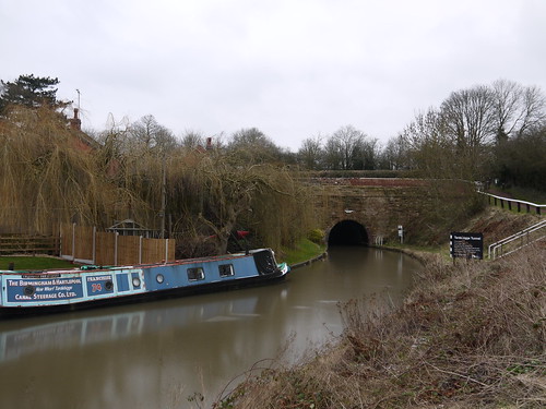
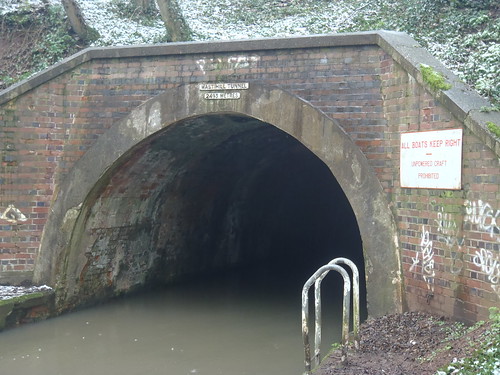
Tardebigge Tunnel
Tardebigge Tunnel
Tow Path
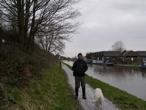
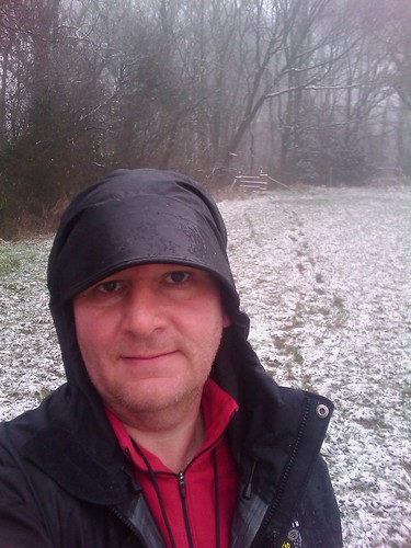
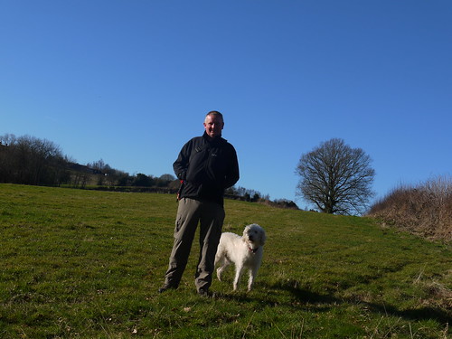
On the Tow Path - Snow and new Gaiters
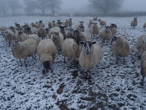
The walking is nice and easy with nothing to really report.  The only other people out are dayglo joggers and a couple of other dog walkers.  Oh, and a man pushing a carpet along in a wheel barrow.
 
Nothing much to look at apart from the reservoir and the famous flight of locks.
 
 
Reservoir Dog
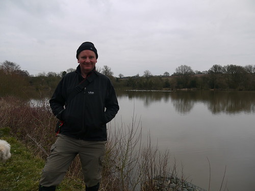
Tardebigge Reservoir and a Toasty Hat
Cache number two of the day is at a bench by the reservoir.  Soon found, even if I do have to lie prostrate before the gods of geocaching.

I leave the towpath at the scene of a previous DNF.  Cachemate tells me that I logged that "I think I know where it is" but as it was 18months ago - I can't remember.  Still can't find it.

Across a stream and field at Copyholt Farm to pick up some lane walking.  No cars, so no problem.  There are a couple of micros along here, which I soon find.

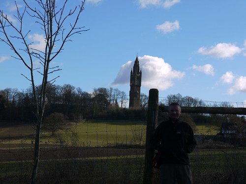
The map shows my route and another geocache on a stretch that is not marked as a footpath.  When arriving, it is however a bridlepath.  Not often an OS Map is lacking some detail.  This takes me past Patchetts Farm.  There are some nice views behind me and back over the reservoir.

Then its lanes back to the Church, where I do pick up the final cache.

Church
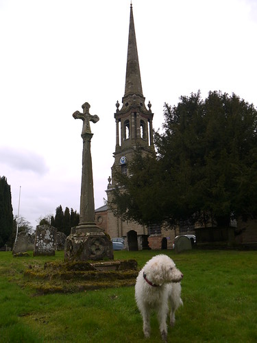
St Bartholomews Pretty 18th Century Church
Is it really Spring?
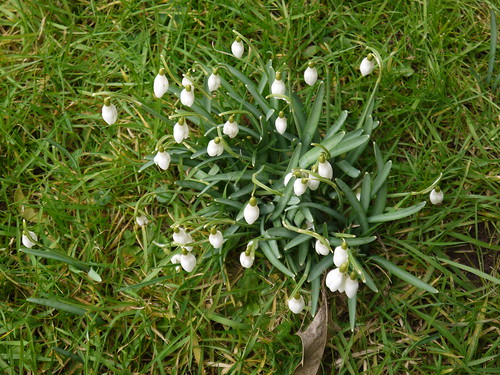
Nature lying and telling me its spring
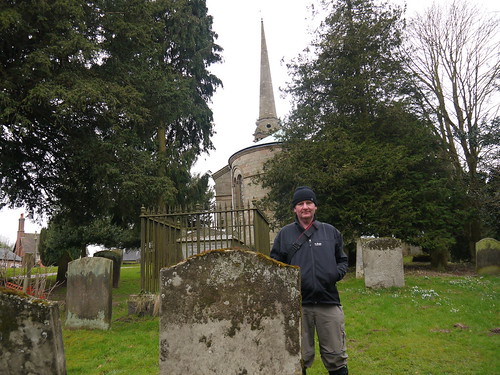
Bone Yard
End of the Walk
Hoping for a longer walk next weekend.

Sunday 17 February 2013

17/2/13 - Return of the Mapp

Distance - 6 Miles
Caches - 3
Walk From - The Times - New Year Walks 2012

Owlpen and Nympsfield


Four times a year, the Times on a Saturday has a supplement of 20 seasonal walks.  Four times a year, I plot them into my database as potential future walking options.  Very occasionally, I actually walk one.

Leave sunny Worcestershire at 9am and head off to Nympsfield.  It sound familiar, but it's not until I get here that I recognise the Rose and Crown pub and realise this is where I stayed when completing the Cotswold Way back in 2007.  I had company then and this dog friendly pub put myself and the labradoodle up for the night.  At first, we had the place to ourselves before the local hunt came in, dressed in full regalia. 

I have never felt more English.


The Pub
Mappiman's Bed for the night - 2007
Today, I am short of a walking partner.  The dog isn't very well, so she gets a sickpass and I head off for the 50 minute journey without her usual whimpers of excitement.

Glorious blue skies have me in high hopes but Nympsfield is at the top of a very steep hill and appears to have its own microclimate. 

I drop down through Dingle wood, slopping around in the mire that is equal parts horse poo and mud, with some very disappointing pictures in the fog.

Dodgy Start
Apparently, the light thing in the top left corner is called "the sun"
There are a number of reasons for choosing this walk.  I rarely need an excuse to get on the Cotswold Way, but today there are some added historical factors.

The first of which is Owlpen Manor, one of England's finest Tudor manor houses - dating from 1200 but extensively rebuilt between 1464 and 1616.  There is the manor house, a church and a number of reasonably priced holiday cottages.  I could have stayed this week for £220 for 7 nights.

I'll save my entrance fee money and see if I can get any photos by using the public footpaths around.  Standing on a bridge and peering over the hedge gets me a result.

Owlpen
Over the Hedge
Owlpen
Public Footpath into grounds
Owlpen
Technically, I probably shouldn't have been here
Having got my fix of Tudor history, I head up to Uley.  I think I have been to this pub before as well.

Uley Pub
England captured in a Photo
This walk needs a 21st Century fix and there is a geocache across from the Church.  Despite a finger tip search of a bus shelter (its was a Cotswold Bus Shelter, much nicer than regular) I gave up.  There was noone around, as you could hear them all singing in the church.
 
More disappointment to follow in the shape of the stiff climb up to Uley Bury.  Think I am still in post xmas out of condition mode, as it is a bit of a lung buster.  At least the 70 year old walkers behind me don't actually manage to overtake me.
 
Uley Bury is our next historical item on the walk.  Its an Iron Age Hill Fort, with a very flat hill top and some excellent ramparts which make it like a tiered cake.  The only decision to be had is which rampart to walk on.  On a normal day, I would have been rewarded with excellent views of the Severn Vale.  Today, you can make do with me next to a tree.
 
Tree
Stunning Views... Usually
There is a geocache in an old biscuit tin which is in remarkable condition, being as the top doesn't fit properly.  At least I have one find today.  Walk my way around to the carpark and there is another multi.  I have a sit on the bench and work out the co-ords, but the final cache is back the way I have come.  The pub is open, so I knock it on the head.
 
Working out the CoOrds
I know where it is, even if I can't be bothered to get it
 
I'm on the Cotswold way now, walking on an excellent path free of mud (hurrah!) as we walk towards our final historical artifact - the wonderfully named Hetty Pegler's Tump.

I have walked here twice and although its marked on the map, I haven't actually found the burial site.  I am afraid that I have no Tump shots to show you this time.

Instead of Tump hunting, I concentrate on my second and best geocache of the day and walking down only to walk steeply back up.  Nothing pleases me more than these sort of rambling work outs.

Cotswold Way
All the way down to go all the way back up - love it.
It's not long before I am back on the road and crossing my last field to get back to Nympsfield, taking in a small cache near a stile.

12:15 and the pub is open.  I get my drink - of course it had to be the Cotwold Way - and adopt my usual post walk position.

P1020312
Happy Mappi
But what am I doing?  I have no filthy hound covered in her usual mix of mud and fox poofume.  I can actually go inside with all the other humans.  The pint is finished off next to a roaring fire, on an old leather sofa - that comes complete with added advice from the management.
 
Sound Advice
Perfect end to a perfect Walk.  Apart from the fog.  And horse poo.

Saturday 9 February 2013

09/02/13 - Wast Land

Distance - 5.3 Miles
Walk From - Village Walks in Worcestershire
Geocaches - 11 found, 2 not found, 1 did not look too hard!
Let Downs - The Weather, The Camera

I have a list of walks to do in the month.  They are all excellent, involve some driving and are of significant distance and natural beauty that they will make all the effort worth while.

I am not going to attempt them when the BBC weather website has a weekend full of big black raindrops.  In reality, its not exactly raining - more like the clouds have come down to take away any views and soak you through.

However, I still need my fresh air, so I look for a local route from my walks library and end up in Hopwood.  I last started a walk from the Hopwood House pub in the year that we got the labradoodle - 28/12/03.  Just where have 10 years gone?

Plot the route and there an unexpected number of caches on route.  Thats a bonus.

Its a bit early to park at the pub, so I park down a snowy lane and head off to the canal.

P2090003
Canal Dreams
First cache is on the road at the top.  Soon found and then a drop down to the canal to make my way towards the Wast Hill Tunnel.  At 1.5 miles, its one of the longest tunnels still working in the UK, bargefans.  There's a cache at the bottom of the steps - one of Stranglers (band) series of caches, that I have found a few of in the past.

P2090005
Tunnel of Love
Then its a climb to the top of the Wast hill.  The mist is down and the sheep think we have something for them as they come running on mass and start hassling the dog.  this is not the natural order of things.  Maybe the snow has made them hungry?

P2090006
They were worrying my dog
And that's it from the camera.  If you have an Olympus Tough for the bad weather, beware, its is a liar.  It told me I had 2/3 battery when I left for the walk and bang, this is the last photo.  You can see by the mist that we are not going to miss too much.

Caches come thick and fast, as we plod up hill and pick up the North Worcester Path, after turing right past the Autism Centre.

Pretty foul walking, slopping through the mud and mist, as we work our way down to the Peacock Pub.  At least ther are plenty of caches to provide some entertainment.

I do have a minor brainwave about photographic evidence.  Having two teenagers should have made me realise sooner that my sat nav phone has a camera.

IMAG0017
New Pro Pic?
Soon knock this idea on the head.... the weather makes it not worth recording.

IMAG0018
Let's try again with the camera next week
I am back on familar territory as we pick up the Peacock Puba and have been caching around here before.

Get my first "Did not look", as the first muggle dog walkers are out in force down the lane.

More mud sloping down to Stonehill Farm, and surprisingly end up on a set of Rugby pitches. There are no games on but a couple of caches. One, I couldn't find but am fairly sure is still there. The second one had a very obvious clue but there was no cache that I could find. I did, however, find an old Rugby Ball and a CD, so not a wasted hunt.

A little bit of lane walking and we are at Hopwood house. There is of course, a cache. There is also a lorry from Macclesfield delivering all the home made food that make up their two main courses for a tenner offer. Wait for the fella to go before retrieving.

Back along the canal, one more cache and back up to the car. Pleased with myself to have not wasted a day, when a more normal reaction would have been to sit of the sofa and watch Sky Sports. With Biscuits.

Sunday 3 February 2013

03/02/13 - Hard Grafton

Distance - 4.3 Miles
Geocaches - 14 out of 15
First Cache

Grafton Flyford


So, how do you like your winter fields and footpaths?  Knee deep puddles, deceptive marshland that goes up to your calves or muddly fields where you end up with clown style dinner plates of mud on the bottom of your boots?  On this walk, you don't have to make a decision, as all can be equally experienced.

At least the caches were excellent.... and I really needed the numbers, having not done a trail for several months.

Thanks to cache 1, there are details of where to park and we head off down a good looking path that soon turns into a waterchute.  Caches 1 and 2 found easily enough but I always had my fears around cache 3.  The clue of "famous model" led me to believe that "Twiggy" would provide the answer.  No joy.  No doubt, it was under Kate Moss.  A position I have often considered whilst out geocaching.

My mud splattered misery is abated by the laugh I had at cache 4, a two part multi which squeaked on retrieval.  This was the only time on the walk that the dog looked even vaguely interested, although little did she know that she was about to be herded by a sheepdog.  Her own fault for looking so fluffy.

DSC02089
And the Sheep Look Up
Arrive at a road but have to double back to go through the field to Hill Top Farm.  This is where the mud sticks to my feet like glue and I end up taking half the field with me.

DSC02091
Mud Pie
DSC02095
Battle of the Somme
Never has a man been more relieved to do a bit of road walking.

Now I have been caching for over 4 years and just occasionally, I am presented with something unique. Cache 7 is a two stage multi puzzle to determine in the field. I set out all the bits on top of the gate and only look like a minor idiot as a dog walking muggle comes past. I have no idea how I was meant to get the co-ords out of it but I managed to find the final part through "cachers instinct". I was that impressed with myself, I dropped off a TB. Hit the village that the cache trail was named after and walk through picking up the next two caches before heading back into the wetlands.

DSC02096
We are here
There is only one place that cache 11 can be, and luckily, despite sitting in a deep muddy puddle, the cache has survived.  All is not as simple as expected, as the log book needs to be found inside the cache.  I am attempting this when the farmer comes on a quadbike with his two sheep dogs for feeding.

I hastily sign and pack up the cache to move on, but one of the dogs thinks that I have stolen one of his charges.  Molly is suitably embarassed at being rounded up but we manage to make our escape.

Unfortunately, we have to double back around these fields to get the remainder of the caches and we bump into the farmer and his dogs several more times as we complete the round.  I would love to know what he thought I was doing, caked up to my knees in mud and wandering around in apparent circles.

Expected something good from the last cache and it didn't disappoint.  A 1 in 25 chance of getting it right.  This is why I don't gamble.  I needed 23 goes.

Follow the outbound route back to the car.

DSC02097
Spent rest of afternoon cleaning the Geowagon
Conditions made for a poor walk but the quality of caches put a smile on my face. Thanks to Chickowee for the trail and the unusual caches.

Saturday 2 February 2013

02/02/13 - Camra Pub of the Decade

Walk Inspiration
Distance - 5.5 Miles
Caches - 2 on route, but already found


This walk has been a long time coming.... it's been three weeks since my last walk.  Two weekends ago, we can blame the snow and in the meantime, I have visited four Canary islands, eaten chicken tagine in Morocco and ascended a Maderian mountain by cable car to be pushed back down in a whicker basket by two blokes in clogs.

No one can accuse Mappiman of wasting his time.

Whilst having plenty of time to think on hols, I came up with a plan to combine walks with the top 10 county pubs in Worcestershire and neighbouring counties.  Number 4 in the list is the Bell at Pensax, with a score of 8.3 out of 10. 

Next is to find inspiration for a walk and again, www.walkingworld.com provides value for its subscription money.

By the look of the skies, we have brought the good weather back with us.  Park up at the layby over the road and head off into the beautiful British countryside.  This walk has stunning views all around.  Much better than a moon landscape made of volcanic ash.
 

P1020247
Blue Skies all around
Snead common is all farmland with plush green fields.  Only problem is that it does turn into a dog obstacle course, with increasingly complex stiles to navigate at each field boundary.  I am sure that one of them could be a substitute for Becher's Brook at the grand national.

Pass Hawley Farm, New England (cue humming Billy Bragg Songs) and then Worsley Farm.  Should have read the walk instructions, as the sign posts dry up - but the right of way is up someones drive.  No wonder they have taken down the sign - wouldn't think I would like goretex clad strangers and their dirty dogs coming on my land.  I take a small detour but soon find myself on track.

We are soon in Abberley, a place that I have walked through many times.  There is a rumour that the Manor Arms is closed again, but at just before 12pm, there is a lot of clanging of beer barells emanating from within.  I have high hopes it's back up and running.

P1020255
A pub, but not the pub
A stiff climb up the hill but rewarded with views in all directions.  I now know why I have only ever come down this way on my previous walks.  We are aiming for the Clock Tower at the Abberley School - a landmark that can be seen all over the county.

P1020263
Great Feature - but its not 13:15
P1020266
Lurking in the Shadows
Drop down on new paths to me that bring me out to the Elms Hotel and then a nice walk through the woodland of Ridding Coppice to get back to the reason why I am here.

P1020270
The Bell
P1020275
Molly looks for food, rather than the camera
P1020277
Not just number 4 pub in the county - Camra pub of the decade
 
The pub has wonderful open fires that welcome a weary walker.  However, I have picked up rather too much worcestershire mud to sit inside. My mother in law did advise me to wear my specially laundered gaiters, advice I should have heeded. 

I de-boot, order my hobsons and have plenty of time to take photos of all the awards and old brewery signs that adorn the outside.

I will be back to test the menu when more suitably attired.