Sunday 30 November 2014

30/11/14 - Broken Bridge

Distance - 4 Miles
Geocaches - 4
Walk Inspiration - Millennium Way Stage 18

 As we nearly enter the festive season, I only just manage to fit in my monthly walk on the Millennium Way.

This is another short leg, with some repetition from Stage 17.  The order to do the walks gets a bit confused around middle England and for the next 6 legs, it looks like I will be seeing some of the same paths from different perspectives.

Today, I park up at Packwood Hall.  Having not seen any Family Mapp visitors before, it's had me twice in 6 weeks, my parents once and they are even talking about going back for the carol service.

Turn right out the car park and once again up to the Church at Packwood Hall.

Church
Observant Blogfans will have seen this before
Take the opposite path to last time.  There is a cache here.  I manage to find it, dismiss it and the have a closer look to see that yes, I had the cache in the first instance.  Conclusive proof that woodlice and slugs love geocaching.

Meet some fellow Labradoodle owners - although you would have been hard pressed to guess.  Mine wins the Doodle beauty contest paws down.

Get to the road at Chessett's Wood Farm and I can see a sign on the footpath post.  This invariably spells bad news and means something is up.  True to form, the sign details that a bridge is in poor condition and the footpath is closed for a month.

What to do?  The map shows no alternative paths and I would be a poor adventurer if I turned back at the first sign of trouble.  Anyway, it may not turn out to be that bad.

Planning Rethink
Get the feeling that the footpath officer wanted a career taping off crime scenes?
Still, there's alway a way.  Even if it means picking the dog up (she'd developed the ability to sadly sign when doghandled unexpectedly) and chucking her over a fence.

That obstacle overcome, I just need to gentlly walk through fields with evil horse guardians.

Over the railway and a quick diversion to the canal for a cache.  I would have saved it for the next leg, but it promised a Travel Bug.  Alas, it was empty except for the log book, so I make good and place one of my own in it.

Diversion
Went for a Travel Bug
Back to Valley Road and past a few country cottages before entering the grounds of Packwood house from a different direction to last time.  This time, there is a tree lined avenue to greet my march.

Packwood House Grounds
Packwood Avenue
Festive Holly Tree
Continuing the Festive Theme - Holly Tree (cache close by)
Packwood Avenue
Easy Route Finding

Options
Packwood House - Entertainment Options
Packwood House
Back to the House
I am getting to know this neck of the woods well now, so I know my choice of post walk entertainment.  It could be Packwood house Tea Rooms or the lovely pub that has the TeePee from two legs ago.  But which one should I grace with my presence?

The TeePee has been taken down for the Winter.

Saturday 29 November 2014

29/11/14 - The Battle of Worcester

Distance - 4.7 Miles
Geocaches - 5
Walk from - Battlefield Walks in the Midlands


A Teenager's broken iPhone led to a last minute change in walking plans.  It was going to be a blast over Long Mynd, but the prospect of leaving a 16 year old with no means of communication meant that we hit Worcester.  We can drop the phone off at the repair shop, complete a walk and take in some Xmas cheer in the markets.

Drop Sonia off at the shop and find the only car park that has spaces left.  Meet up with her at the bridge to start the walk going.

The cathedral bells are peeling, luring in the Christmas punters.

Worcester
Worcester - Heading into the Sun
Worcester
The Labradoodle was strangely scared of the pigeons
The advantage of this walk over the Long Mynd is that there are some caches to find.  First one in a wall is easy enough but then we get two DNF on the bounce.  When I am king, I will ban caches on bridges.

Get back in the game with an easy Micro near Diglis Island.

The purpose of this walk is to reach the site of the Battle of Worcester - 1651.  This is the one where Charles II met Cromwell and was thrashed, escaping the city to go and hide in a tree at Boscobel House.  The route of his escape, forming the Monarch's Way LDP, that I keep meeting at random parts of the country.

The main site of the battle was on the other side of the river.  On my side, there is a cache in some rough land that I make a half hearted attempt at.  There is a tent in the woodlands and I always find these a little bit sinister.  I abandon the hunt.

The route in the book would have us retracing our steps, but the paths have become very muddy.  Instead, we cut inland to the houses, finding our last caches in a park and then along the canal.

Worcester - Canals
Canal back to Town.
The canal, via the commandery and then Fort Royal (which I never appreciated was man made until I read this book) returns us to the town.

A last tour of the Cathedral - where Charles II stood at the tower and saw his armies defeated - before the madness that is a city centre four Saturday's before Xmas.

Worcester - Catherdral
Resting Place of King John and the Arthur, brother of Henry VIII
Worcester - River
River view from the Cathedral


Battle the crowds to the dine on fine scones at the Boston Tea Party.  All that remains is to collect the phone - we are hopeful it will last the 6 months until its out of Contract.

Saturday 22 November 2014

22/11/14 - Slow Cotswolds

Distance - 7.5 Miles
Geocaches - 2
Walk Inspiration - Jarrold - More Cotswolds - Walk 24


A walk in celebration of my new Guide Book, which plopped through the post box earlier this week.

9781841623443_24
Why all that rushing around?
It's a bit of gem to be honest, promising a wealth of exploring.  And it could be my mantra for the new year - taking my time, understanding the area that I am walking and making sure I visit everything close by that offers adventure.

That is until I get home 6 hours after leaving this morning and get a greeting from Sonia along the lines of "Where the bloody hell have you been?"

The walk is from the perennial favourite Guidebook, Jarrold.  Very rarely disappointed by the walks in here and this one has been marked as "todo" in my list for the last two years.

Armed with all the knowledge of Eastleach and the promise of "noble oases of peace", I head off under dark grey skies.

This is agricultural Cotswolds and not much to report until we hit the Leach Valley.

Eastleach
First View of the Leach
Eastleach
A Thames Tributary - literally coming out the ground at this point
The walk heads upstream up the Leach, to then go around some fields and head back down on the otherside.  The valley is certainly the highlight, where I walk along the stream, with high banks from its former glory flanking me on either side.

Eastleach
The Valley Floor
I walk around the wonderfully named, but little to observe,  Macaroni Downs.  The weather takes a turn for the sinister that forces me to hide in a strategically placed pigsty.

What do you folks get up to on your weekends?

Eastleach
You can see what happens next
Eastleach
Did we give permission for you to hide in our house?
The shower, as intensive as it is, is mercifully short.  I am back on the walk, through woodland and picking up the River Leach again.

Eastleach
River Leach - Autumn Colours
Eastleach
After the Rain

Eastleach
First of Two Similar Bridges
Not long before I heading back into the town.  There are only two caches along the route and they are both found quickly.  Two things remain - check out the two churches on either bank of the Leach.

Eastleach
Eastleach Martin Church
Eastleach
Eastleach Turville Church
And to check out the pub.  It looks wonderful, perched high above the town and of course, in perfect harmony with its surroundings.

But there is a potential problem.

Victoria Inn - Eastleach
Victoria Inn Ahead
Victoria Inn - Eastleach
Oh No - Its Arkell's

Blogfans will know that I have been doing a lot of walking in this area on the Ridgeway.  And I have been asking questions of the local brewer Arkells.  I have tried two different beers in two different pubs and been massively underwhelmed.

Giving the benefit of the doubt and hoping for third time lucky, I go for a 3B.

And the result?

There is a reason why all the other punters in here are drinking Peroni.


Sunday 16 November 2014

15/11/14 - London Loop in a Nutshell

Distance - 14 Miles
Geocaches - 14
Start - Cockfosters
Finish - Chingford


Traditionally, Stage 12 of the London Loop should have ended after a more sedate 9 miles, at Enfield Lock Station.  Once again "Planned Engineering Works" on our railway system have meant a change of plan.  There really is no need to kick start the economy with HS2.  We are spending loads maintaining our existing infrastructure.

So, I will attempt to force three stages into two - even if we are double digit walking from now until the end of the Loop.

This stage is a perfect representation of the Loop.  Some fine walking, some unexpected oddities and the delights of walking past the chicken shops of some run down satellite town looking like an oddball in a Soft Shell Suit, carrying a rucksack.

It starts off wonderfully - the loop passes the entrance to Cockfosters Underground, so I am straight on it and into Trent Park and the former Royal hunting park of Enfield Chase.

London Loop Stage 12
Into the Woods
Wild woodland walking, with many cross country runners for company.  Three caches to find, the third at Camlet Moat.

This is what the Loop needs - a fine Arthurian legend.  Could this be the site of the legendary Camelot?  It certainly has it's royal associations and ghostly legends.

London Loop Stage 12
Avoiding the temptation to say it is "A Silly Place"
London Loop Stage 12
Autumn Colours.
Exit Trent Park at the Obelisk and cross the road into fields onto good green lanes.  This is notable for a start of a cache trail names after the London Loop.  And for the sun showing itself for the first time today.

London Loop Stage 12
This is London
Looking at some of the cache logs and other London Loop Logs, it would appear as though someone has been living on these paths since the summer.  There is talk of a large yellow tent and sure enough, even in November, it is still there.  The guy ropes are looking a bit slack but it's still standing.  I found it all a bit Blair Witch and scuttled off to the next cache.

With the extra miles and a named train to catch on the way back, I need to get a move on.  It's two hours by the time I reach Cuckolds Hill and I have only done about 4 miles.  At least there is a lengthy stretch with no caches which should enable me to gain speed.

London Loop Stage 12
If I don't Gallop, I will miss the 16:23 Return
Still in the countryside wilds, the loop delivers me to Turkey Brook.  The loop cannot help itself when it comes to water and this provides the navigational hand rail for a number of miles.  Good job it is fine walking.  Alas, too early for the first pub of the day that we pass.

London Loop Stage 12
Turkey Brook
London Loop Stage 12
Reputedly owned by Dick Turpin's Grandparents.  They loved the footie
By 12:30pm, I am delivered to Enfield Lock Station, the original end.  It's clear to see why I won't be going back into London this way.

London Loop Stage 12
No doubt phoning Poland to get the resources to finish the job.
So I continue, into the very uninspiring Enfield Wash, through housing schemes, past closed pubs and through inner city high streets.  A good couple of miles before I get into better walking territory at the River Lee Navigation.

This is a confusion of man made water ways, filling into the seemingly huge King George Reservoir.  As you cannot see over the banks, you are not quite sure of the scale.   On the map, it looks all of it's 420 Acres - making it the largest in London.

London Loop Stage 12
River Lee filling the Reservoir - hidden behind the green banks
It about this time that the legs are starting to feel it.  The signs aren't helping.  I can cope with Chingford Station being 3 miles away but not when I walk for 20 minutes and the next one tells me its 3.5 miles away.

After some lonely walking (all uphill), I reach the Scouting Facility of Gilwell Park.  You have to love Scouts.  They plant geocaches.  And there a three to get in quick succession.  With the height gained, I also get the first look of London that the loop has provided for sometime.

London Loop Stage 12
Scouting Badge for Survellience 
London Loop Stage 12
London - 10 Miles as the Crow Flies
Thankfully, after a slop through the park, Chingford is all down hill.  A last cheeky cache and then my reward opposite the station, in the only way I know how.

London Loop Stage 12
Deserved.


Saturday 8 November 2014

07/11/14 - Valley of the Racehorse

Distance - 13.5 Miles
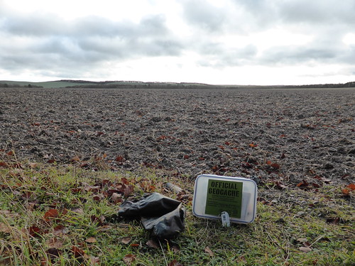
Geocaches - 39
Walk Inspiration - Self created Part 6 of the Ridgeway
Distance on Ridgeway - 5 Miles

The last walk of my week off work.  The 6th Circular walk on the Ridgeway.  I am making progress as this one takes in two counties (Oxfordshire and Berkshire) and is lengthy.

Weather report is grim, so everything waterproof is packed.  You could argue that I was in fact lucky with the weather, with 5 hours of dryness and 1 hour of rain.  But that hour was as bleak a moment as I have had in my walking career.

Park up on the Ridgeway at Ashbury Hill.  There is a camera crew taking up most of the spaces but room for me to squeeze in.  I ask them what they are filming and the cameraman shrugs and says "Dunno, cars driving past or something".  He agrees with me that this will not be worrying the 2015 Oscar Committee.

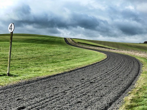
Head off  on the Ridgeway, repeating a short section from Stage 5.  This section is cache laden - I know it will be a good day when cache 1 has a Travel Bug in it.

Cache 1 of the Day
Cache 1, complete with Travel Bug
There are just too many caches on the route today to describe.  They are perfect for this sort of walk - all nice and easy to find (apart from the 1 DNF), with great clues and are all in perfect condition.  Thanks to the COs for the trails.  My numbers have picked up.

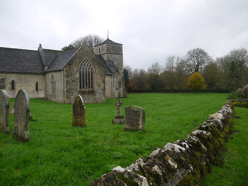
The first archaeological highlight of the day is Wayland's Smithy, the Second Neolithic Long Barrow encountered on the Ridgeway.

Mappiman at Waylands Smithy
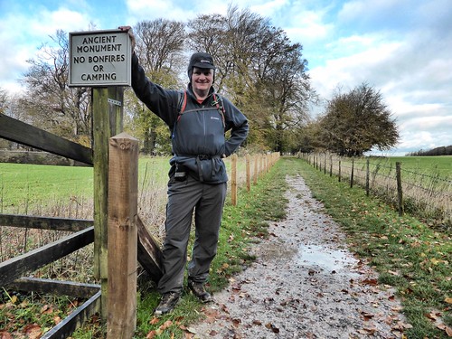
Prepared for the bad weather
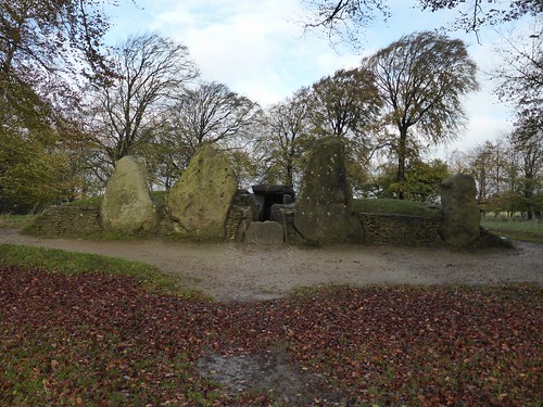
Waylands Smithy
Wayland's Smithy
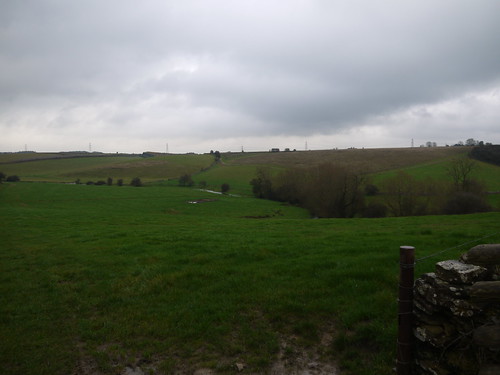
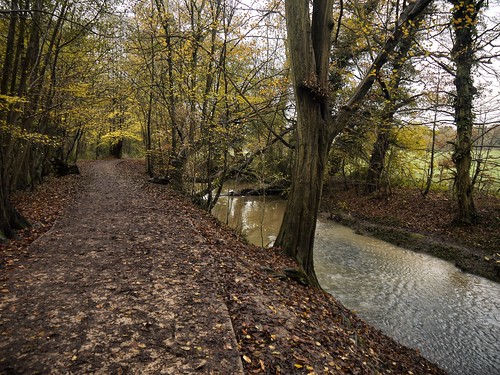
Spend a bit of time exploring and taking in the atmosphere and then move on to the Ridgeway - which is showing itself off in all its glory today.
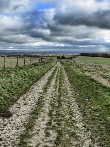
The Ridgeway - in all its Glory
The Ridgeway
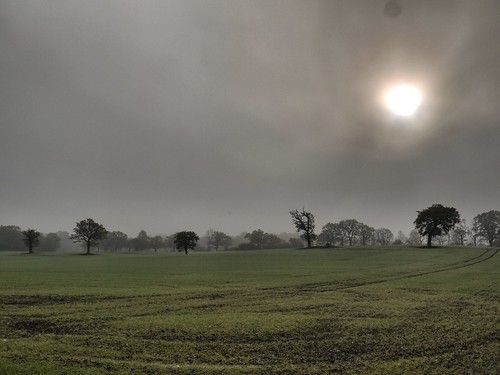
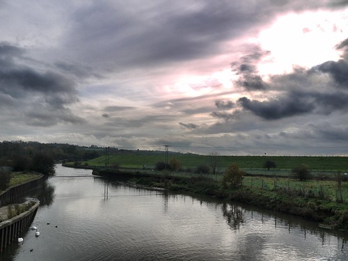
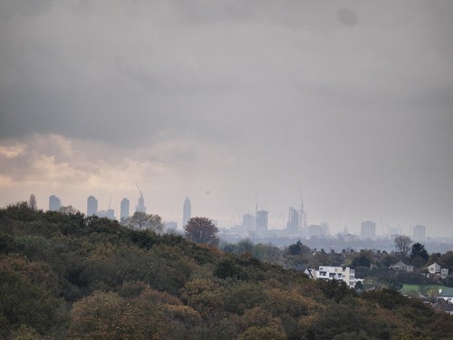
There are superb views to the North and East, with Didcot Power Station revealing itself in the distance.  The bad weather is behind me, but soon catching up in the wind.  From White Horse Hill, a rainbow forms in the vale below.

Rainbow down in the vale
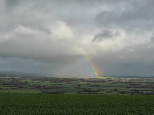
Beginnings of a Rainbow
I am hoping that I get to see the Chalk White Horse on the side of the hill when I drive to Stage 7.  I just have the views from the top.

I leave the Ridgeway at Sparsholt Firs and catch a glimpse of the first equine activity, as three horses are out training.  I have to time my caching hunts when they are at the far end of the track.
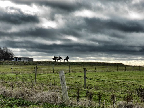
First sight of the horses
First of the Horses
Sparsholt Firs
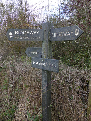
Leave at Sparsholt Firs - Of course, there is a cache.
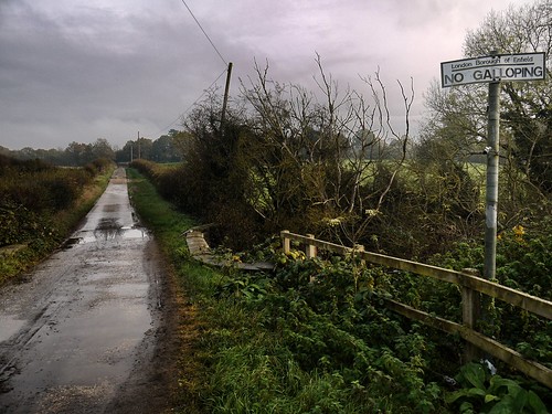
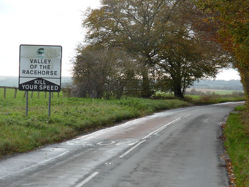
A bit of roadwalking, leaving Oxfordshire and entering Berkshire.  I am in the Valley of the Race Horses and I can see around 20 training at Eastmanton Down.

Into Berkshire
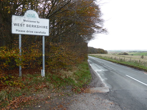
Wiltshire, Oxfordshire, Now into Berkshire
And the Valley of the Horses
Sequel to the more popular Dolls
Leave the road at the less photogenic neolithic Seven Barrows and follow the racecourse around to Crog Hill.

Kingstone Warren Down
Uphill and Bad Weather Approaching
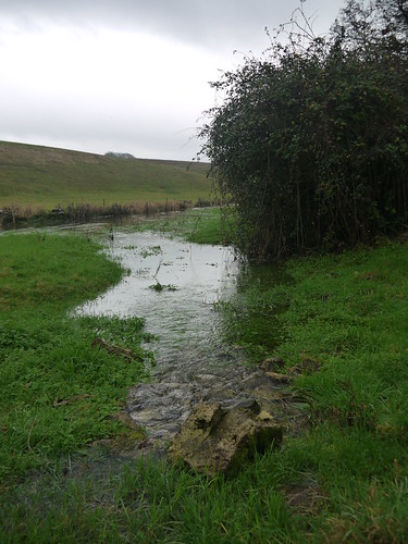
This is where my bad hour kicks in.  Its a trudge to the top of the hill and I think the week's walking have taken its toll on my legs.  At the crest of the hill, its exposed downland for as far as the eye can see.  This is very pretty but offers no respite from the wind.  If I had company, we would not be able to hear each other.

And then the rain starts.  Not gentle rain but sideways, face stinging rain.  Everything Goretex is applied but questions are asked of myself as I slip and slide through the mud.  A low point was the cabbage field.

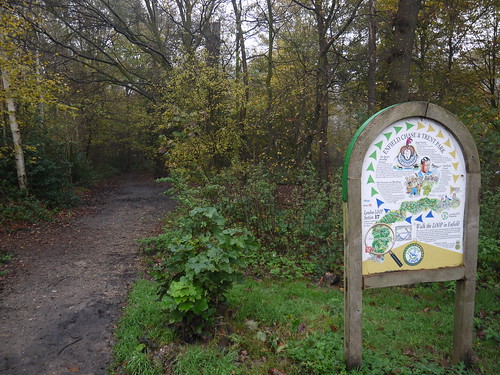
Relief comes in the form of Kington Plantation.  The trees offer a gap from the wind, the rain knocks off and there is a mighty cache trail to lead me back to the car - which truly is a sight for sore legs when I reach it.

Relieved to get to the GeoWagon
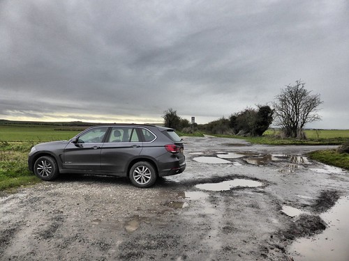
Crew have finished their epic "Cars Driving Past 2"
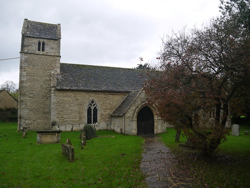
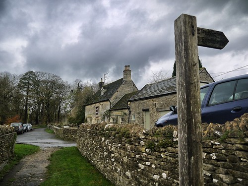
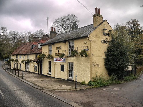
Decide to revive spirits by taking a look at Ashbury.  Surely it has a pub?

Ashbury - Picture Postcard Village
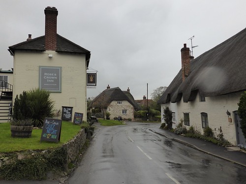
Picture Postcard - and Everything I need
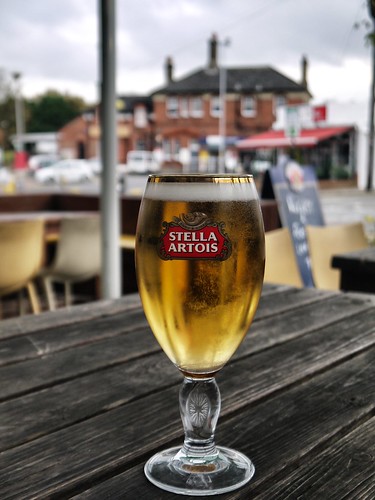
I dream of a perfect pint in front of a roaring open fire.  By the amount of walking boots scattered by the doorway, it looks like a popular walkers pub.  It nearly all works out as planned

Now I have a serious question for Wiltshire Blogfans.  This is the 2nd pint of Arkells I have had in the area and both have been terrible.  Cloudy and tasteless.

Is the beer meant to be like this - or do I keep striking unlucky?

is Arkell's meant to look like this?
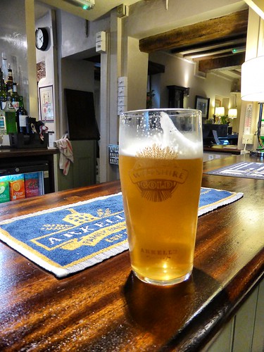
I'd be off to the Doctors if my Wiltshire Gold looked like this
I tweet the question to the outside world.  I get one response.  Mrs Mappiman tells me - "Not to drink it then".

Sound advice in principle, but I have paid for it.